| |

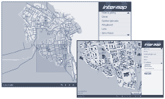
Municipalities
Fast, user-friendly digital map content management system
designed for Municipalities to convey street maps, location
of service facilities and related information, hiking trails,
road conditions, repairs and accidents, etc. to the public.
Non-tech administrators can input and update digitial maps,
information categories and information such as text and pictures
through a web-interface, as well as certain information by
mobile phone in real-time. End-user features include:
• searching by keywords or categories,
• fast zoom and pan
• printing of maps or other information,
• measuring distances.
|
|
|